
AI in Geospatial Market expected to be worth around USD 1,165.3 Million by 2033
Increasing use of AI-powered mapping, satellite imagery analysis, and location intelligence is driving market growth.

The Global AI in Geospatial Market size is expected to be worth around USD 1,165.3 Million by 2033, rising from USD 78.3 Million in 2023, and it is projected to grow at a CAGR of 31.0% during the forecast period from 2024 to 2033. The strong expansion of this market is associated with the increasing use of artificial intelligence in mapping, remote sensing, satellite imaging, and spatial analytics.
Governments, urban planners, and enterprises are adopting geospatial intelligence to support infrastructure planning, climate monitoring, agriculture, and defense operations. The integration of machine learning with satellite and drone imagery has significantly improved the accuracy of spatial data analysis. The rapid growth of digital mapping technologies and the expansion of Earth observation satellite programs have created a large volume of spatial data worldwide.
Artificial intelligence is increasingly used to process this data efficiently, allowing organizations to extract meaningful geographic insights. The adoption of smart city initiatives, environmental monitoring systems, and precision agriculture platforms is also contributing to the growth of AI-powered geospatial technologies. These factors are collectively supporting the development of advanced geospatial analytics across multiple industries.
What is AI in Geospatial Market?
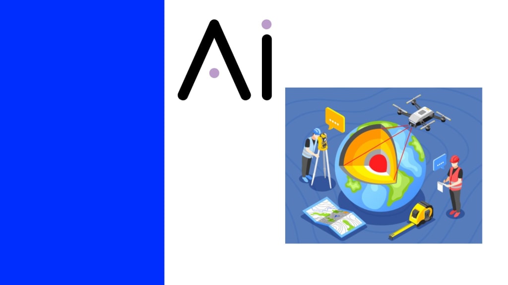
AI in geospatial refers to the integration of artificial intelligence technologies with geographic information systems (GIS), satellite imagery, and spatial datasets. These systems analyze geographic information to identify patterns, detect environmental changes, and generate predictive insights related to land use, climate conditions, and infrastructure development. Machine learning algorithms are commonly used to process large spatial datasets generated by satellites, drones, and mapping sensors.
The demand for AI in geospatial technologies has increased as organizations seek faster and more accurate methods of analyzing geographic data. Governments and enterprises rely on these systems to monitor urban expansion, natural disasters, and environmental changes. Business benefits include improved decision making, reduced operational costs, and more efficient resource management. The rising demand for location-based intelligence in sectors such as agriculture, transportation, and defense has further strengthened the adoption of AI-driven geospatial tools.
The Role of AI
Artificial intelligence plays a significant role in enhancing geospatial data processing and analysis. Traditional geographic analysis methods often require manual interpretation of satellite images and mapping data. AI technologies such as deep learning and computer vision can automatically analyze satellite imagery and detect geographic patterns, which significantly reduces processing time. This automation has improved the speed and accuracy of geographic information analysis.
AI also supports predictive geospatial analytics, allowing organizations to forecast environmental or infrastructure changes. For example, AI models can analyze historical satellite imagery to predict urban growth patterns or detect early signs of deforestation. These predictive capabilities are particularly valuable for disaster management, environmental monitoring, and climate research. As data collection technologies expand, the role of artificial intelligence in geospatial systems continues to become more important.
Scope and Research Methodology
The scope of the AI in geospatial market includes technologies such as machine learning, deep learning, computer vision, and spatial data analytics integrated with geographic information systems. These technologies are applied across industries including agriculture, defense, environmental monitoring, transportation, and urban planning. The market also covers applications involving satellite imagery analysis, drone-based mapping, and spatial data visualization platforms.
The research methodology for analyzing this market typically involves a detailed evaluation of technological adoption, industry demand patterns, and regional development initiatives related to geospatial technologies. Data is commonly gathered from public research publications, satellite data programs, government spatial initiatives, and industry reports related to artificial intelligence and geospatial analytics. This approach helps in understanding technological progress and identifying emerging opportunities in the global geospatial intelligence ecosystem.
Key Forces Driving Market Expansion
The expansion of Earth observation satellite programs has significantly increased the availability of geospatial data worldwide. Hundreds of commercial and government satellites now capture high resolution images of the Earth daily. Artificial intelligence technologies are required to analyze these large datasets efficiently. The combination of satellite imaging and AI-driven analytics has therefore become an essential component of modern geospatial systems.
Another key force driving the market is the global rise of smart city initiatives and infrastructure monitoring programs. Governments across many countries are investing in geospatial intelligence to support urban planning, transportation networks, and disaster preparedness. AI-enabled geospatial platforms provide real time geographic insights that assist decision makers in managing urban growth and environmental sustainability. These factors collectively strengthen the long term development of the market.
Emerging Trends Analysis
One emerging trend in the AI in geospatial market is the increasing use of satellite constellations combined with artificial intelligence analytics. Companies operating Earth observation satellites are generating vast amounts of geographic data every day. AI algorithms are used to automatically identify features such as roads, buildings, agricultural fields, and environmental changes. This trend is significantly improving the speed of geographic data interpretation.
Another noticeable trend is the adoption of AI-powered drone mapping technologies. Drones equipped with sensors and cameras can capture high resolution spatial data in real time. Artificial intelligence systems process this information to create accurate digital maps and terrain models. These technologies are increasingly used in construction, mining, agriculture, and disaster response activities.
Driver Analysis
One major driver of the AI in geospatial market is the growing demand for environmental monitoring and climate analysis. Satellite and geospatial data are widely used to monitor deforestation, glacier melting, ocean conditions, and land use changes. Artificial intelligence systems help analyze these datasets and identify environmental patterns more efficiently. This capability is particularly important for governments and international environmental organizations.
Another key driver is the expansion of precision agriculture technologies. Farmers are increasingly using satellite imagery and geospatial analytics to monitor crop health, soil conditions, and irrigation requirements. AI-based geospatial tools provide insights that help improve agricultural productivity and reduce resource wastage. The adoption of such technologies has increased significantly in regions with advanced agricultural monitoring systems.
Restraint Analysis
Despite strong growth potential, the market faces certain limitations related to data complexity and integration challenges. Geospatial datasets are often large and require advanced computing infrastructure for processing and storage. Organizations may face technical challenges when integrating AI models with existing geographic information systems. These technical barriers can slow down adoption in some industries.
Another restraint is related to data privacy and security concerns. Geospatial systems often collect detailed geographic information that may include sensitive infrastructure or population data. Governments and regulatory agencies impose strict guidelines on the use and distribution of geographic data. Compliance with these regulations may limit the availability of certain datasets for commercial AI applications.
Opportunity Analysis
A significant opportunity in this market lies in the growing adoption of autonomous transportation and navigation technologies. Self driving vehicles and advanced navigation systems rely heavily on precise geospatial data. AI-enabled mapping and spatial analysis technologies help improve route planning, traffic monitoring, and road safety analysis. This creates new demand for advanced geospatial intelligence solutions.
Another important opportunity is the increasing use of geospatial AI in disaster management and emergency response systems. Governments and humanitarian organizations use satellite imagery and AI analytics to detect floods, wildfires, earthquakes, and other natural disasters. These technologies help authorities respond quickly and allocate resources effectively. As climate related disasters increase globally, the need for AI-driven geospatial monitoring systems is expected to expand.
Challenge Analysis
One of the main challenges in the AI in geospatial market is the shortage of skilled professionals who possess expertise in both artificial intelligence and geospatial science. These systems require specialized knowledge in machine learning, remote sensing, and geographic information systems. The limited availability of professionals with interdisciplinary expertise can slow the development and deployment of advanced geospatial AI solutions.
Another challenge is related to the high cost of satellite imagery and spatial data acquisition. High resolution satellite images and advanced mapping technologies often require significant financial investment. Smaller organizations and research institutions may find it difficult to access such datasets regularly. These cost constraints may limit the widespread adoption of AI-enabled geospatial analytics in some regions.
Top Use Cases
AI in geospatial technologies is widely used in urban planning and smart city development. Governments and urban planners use satellite imagery and spatial analytics to monitor infrastructure expansion, traffic patterns, and population density. Artificial intelligence systems analyze geographic data to support long term urban development strategies and efficient land use planning. These applications help improve transportation systems, housing planning, and public service management.
Another important use case is environmental and agricultural monitoring. AI-powered geospatial platforms are used to track crop conditions, monitor water resources, and detect environmental changes such as deforestation or land degradation. These systems provide real time geographic insights that assist farmers, environmental agencies, and policymakers. The growing emphasis on sustainable resource management continues to increase the demand for geospatial intelligence solutions.
Conclusion
The AI in geospatial market is experiencing strong development as organizations increasingly rely on geographic intelligence for decision making. Artificial intelligence technologies allow large volumes of satellite and spatial data to be analyzed quickly and accurately. The combination of AI with satellite imaging, drone mapping, and geographic information systems has created new opportunities across industries such as agriculture, defense, urban planning, and environmental monitoring.
Future growth of this market is expected to be supported by the expansion of satellite observation programs, smart city initiatives, and climate monitoring systems. At the same time, challenges related to data integration, cost, and skilled workforce availability remain important considerations. Despite these limitations, the continued integration of artificial intelligence with geospatial technologies is expected to significantly enhance the value of geographic data in the coming years.
About the Creator
Roberto Crum
I am blogger, digital marketing pro since 4.5 years and writes for Market.us. Computer Engineer by profession. I love to find new ideas that improve websites' SEO. He enjoys sharing knowledge and information about many topics.
Keep reading
More stories from Roberto Crum and writers in Futurism and other communities.
Financial Planning Software Market to reach USD 18.2 Billion By 2033
The Global Financial Planning Software Market size is expected to be worth around USD 18.2 Billion by 2033, rising from USD 4.3 Billion in 2023, expanding at a CAGR of 15.5% during the forecast period from 2024 to 2033. The increasing complexity of financial decision-making among individuals and enterprises has encouraged the adoption of digital planning tools. These platforms help users manage investments, savings, retirement plans, tax strategies, and budgeting activities through centralized dashboards and analytical tools.
By Roberto Crumabout 14 hours ago in Futurism
Healthy Snacks Industry Outlook: Plant-Based Snacks & Market Expansion
According to IMARC Group's latest research publication, global healthy snacks market size reached USD 95.8 Billion in 2025. Looking forward, IMARC Group expects the market to reach USD 148.4 Billion by 2034, exhibiting a growth rate (CAGR) of 4.98% during 2026-2034.
By sujeet. imarcgroupabout 10 hours ago in Futurism
The BAFTA Awards
By now, in a stunning departure from recent years, most of the world is aware of what happened at the BAFTA film awards. Social Media Headlines will tell you the bare bones: that John Davidson, a Tourette's Syndrome advocate, shouted a racial slur at two Actors of Colour, Michael B Jordan and Delroy Lindo.
By Natasja Rose5 days ago in Psyche


Comments
There are no comments for this story
Be the first to respond and start the conversation.